The following spatial scales must be considered when assessing the avalanche danger for a region.
Forecasting domain
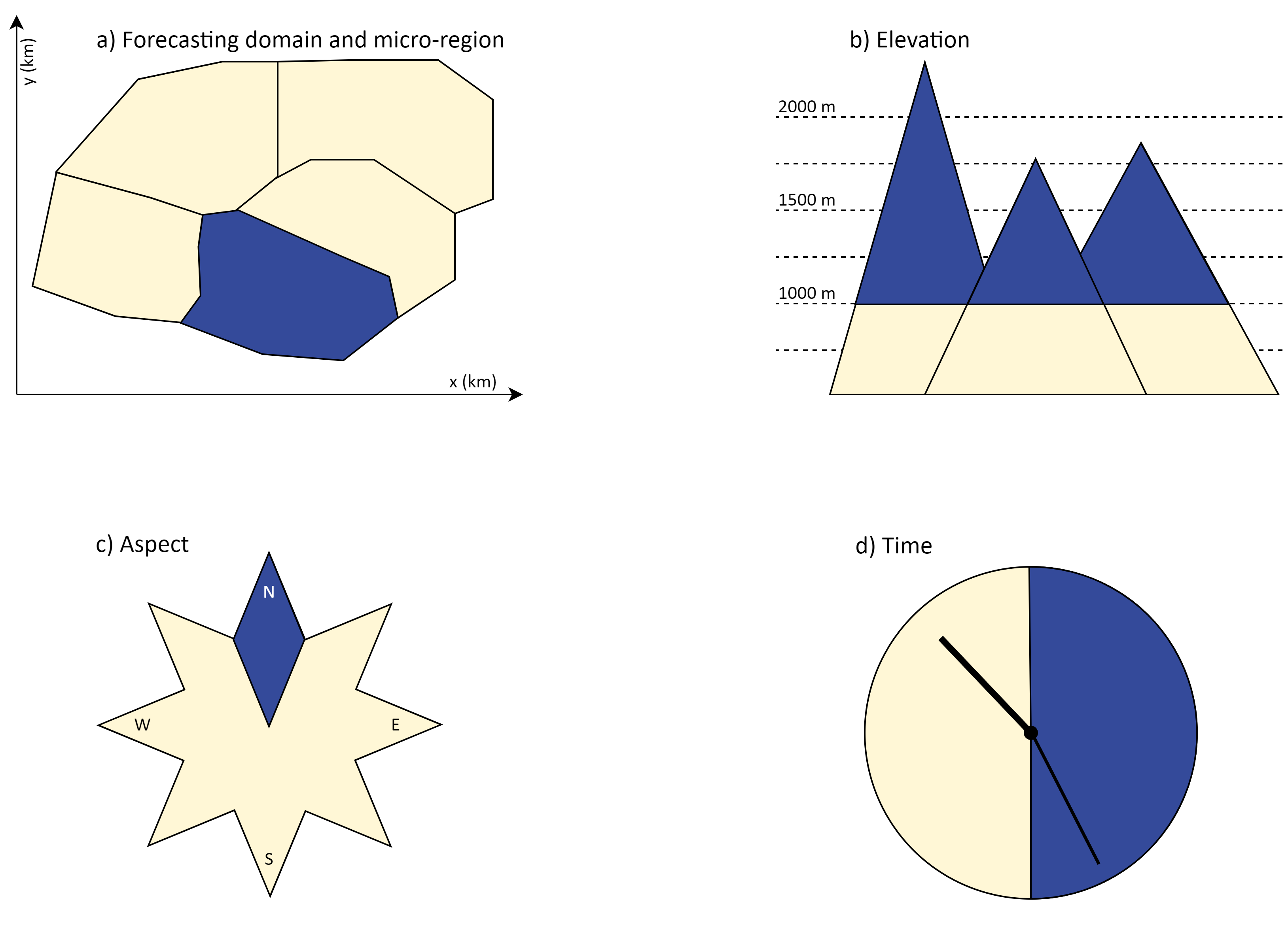
Forecasting domain is the area of responsibility of an avalanche warning service issuing public avalanche forecasts. The forecasting domain is generally static for a service/operation (e.g. the entire bound of Figure 1a).
Micro-region
Micro-regions are the smallest, geographically clearly specified areas used for avalanche danger assessment (e.g. area highlihted in blue in Figure 1a). They are static. Furthermore, they permit the forecast user to know exactly which region is described. They may be delineated by administrative boundaries (e.g., between countries, federal states, or regions and provinces); describe climatologically, hydrologically, or meteorologically homogeneous regions; or may be based on orographic divisions, or a combination of these (Techel et al., 2018).
Reference unit
A reference unit is the smallest spatial-temporal entity at which an avalanche danger level can be assessed. A reference unit can be delineated by different elevations and/or aspects within a micro-region (Figure 1). It must be still large enough to include a variety of avalanche terrain thus that issuing an avalanche danger level makes sense. The reference unit needs to be defined and remains consistent within a forecasting service (and ideally across forecasting services).
Warning region
A warning region is an aggregation of micro-regions, where avalanche conditions are considered similar and are assessed with the same avalanche danger level, critical aspects, and elevations where the danger and the avalanche problems including the danger description prevail. The way they are aggregated may vary from day to day. A warning region is smaller or equal to the forecasting domain and larger or equal to a micro-region.
Resolution
The spatial-temporal resolution used to assess avalanche danger depends primarily on the availability of relevant and reliable data in a sufficient spatial density and temporal frequency. Therefore, the resolution of avalanche danger assessment will vary between warning services. Typically, the following elements characterize the spatial-temporal resolution used to determine the avalanche danger level:
- the size of the micro-regions within a forecasting domain (Figure 1a),
- the resolution of elevation and/or aspect (Figure 1b and c), and
- the temporal subdivision within the valid period of a forecast (e.g., in the morning/evening, Figure 1d).
The resolution of these elements defines the lowest spatial and temporal units at which a forecaster can issue an avalanche danger level, which we refer to as reference unit.